21 Century Building # 517
+82-2-6490-2887
choiys@uos.ac.kr
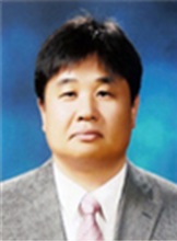
Prof. Yunsoo Choi received the BSc from the Department of Civil Engineering, University of Seoul, Korea 1984, the MSc in Department of Civil Engineering from University of Seoul, Korea, 1986, and the PhD from the Department of Civil Engineering, SungKyunKwan University, Korea, 1992. Since 2001, he has been a faculty member of Department of Geoinfromatics, University of Seoul, Korea. His research interests include National Spatial Reference Frame, Policy of National Geoinformatis, Surveying and Cadastral Resurvey.
Education
1986 – 1992, Ph.D., Department of Civil Engineering, Sungkyunkwan University, KOREA
1984 – 1986, MS., Department of Civil Engineering, University of Seoul, KOREA
1980 – 1984, BS., Department of Civil Engineering, University of Seoul, KOREA
Academic Appointments
2008 – Present, a Full Professor of Geo-Informatics, College of Urban Science, University of Seoul, KOREA
2001 – 2008, Associate Professor of Geo-Informatics, College of Urban Science, University of Seoul, KOREA
1991 – 2001, Associate Professor of Civil Engineering, College of Engineering, Hankyong National University, KOREA
Professional Appointments
2015 – Present, Committee member, Central Cadastral Resurvey Commission in Ministry of Land, Infrastructure and Transport
2014 – Present, Director, KOREA Spatial Information Society
2013 – 2014, President, KOREA Spatial Information Society
2013 – Present, Advisory Committee, Technical planning of Hydrographic Survey in Korea Hydrographic and Oceanographic Administration
2013 – Present, Director, Hydrographic Society of Korea
2013 – Present, Director, Korean Society of Civil Engineers
2011 – 2013, Member, Expert Commissioner in Court
2006 – 2008, Associate Member, Member of Computerization Promotion Committee, Seoul Metropolitan City
PUBLICATIONS
⋅Jeong, In Hun · Kim, Chong Mun · Choi, Yun Soo · Kim, Sang Bong and Lee, Yun 2014. “A study of Establishment on Radiomap that Utilizes the Mobile device Indoor Positioning DB based on Wi-Fi.” Journal of the Korean Society for Geospatial Information System Vol.22 No.3.
⋅Yoon, Ha Su · Chang, Min Chol · Choi, Yun Soo and Huh, Yong 2014. “Analysis of National Vertical Datum Connection Using Tidal Bench Mark.” Journal of the Korean Society for Geospatial Information System Vol.22 No.3.
⋅Kim, Jung Rack · Lin, Shih Yuan · Hong, Sung Wook · Choi, Yun Soo and Yun, Hye Won 2014. “Ground Deformation Tracking Over Mt. Baekdu : A pre-evaluation of Possible Magma Recharge by D-InSAR Analysis.” Journal of Civil Engineering Vol.18 No.5.
⋅Ni, Xiao Jiao · Choi, Yun Soo and Nan, Ying 2014. “A study on Integrated Assessment of Baekdu Mountain Volcanic Aisaster risk Based on GIS.” Journal of Korea Spatial Information Society Vol.22. No.4.
⋅Park, Ho Joon · Choi, Yun Soo and Kim, Jae Myeong 2014. “A study of Accuracy Assessment of Digital Elevation Model in the Greenland.” Journal of Korea Spatial Information Society Vol.22. No.4.
⋅Kim, Jae Myeong · Choi, Yun Soo · Lim, Hyung Tae and Chanh, Cheong Hwa 2012. “A study on the Regulations of Cadastral Surveying in Taiwan.” Journal of Cadastre Vol.42 No.2.
⋅Lee, Sang Jin · Choi, Yun Soo and Yoon, Ha Su 2012. “Estimation of Carbon Dioxide Stocks in Forest Using Airborne LiDAR Data.” Korean Journal of Geomatics 30(3).
⋅Song, Hyun Kun · Kang, Byoung Ju · Lee, Sung Hun and Choi, Yun Soo 2012. “A study for Removing Road Shields from Mobile Mapping System of the Laser Data using RTF Filtering Techniques.” Journal of the Korean Society for Geospatial Information System Vol.20 No.1.
⋅Kim, Jae Myeong · Choi, Yun Soo · Seo Jae Pil and Chang, Eun Mi 2011. “A Preliminary Study of Quality Certification System for Geo-Spatial Information Device.” Journal of Korea Spatial Information Society.
Awards
Best thesis award, Korea Spatial Information Society, 2011
Academic award, The Korean Federation of Science and Technology, 2009
Academic award, Korean Society of Surveying Geodesy Photogrammetry and Cartography, 2002, 2009
Academic award, The Korean Association of Geographic Information Studies, 2008
Official commendation from Ministry of Construction and Transportation, 2000
Academic Courses Taught
Geomatics ScienceⅠ; Undergraduate level
Geomatics ScienceⅡ; Undergraduate level
Laws for Spatial Information; Undergraduate level
LBS and U-City; Undergraduate level
Geomatic Engineering: M.S level
Cadastral Investigation: M.S level
Advanced Topics in Geomatic Engineering : M.S- and Doctoral levels
Advanced Topics in Spatial-Related Laws : M.S- and Doctoral levels
Professional Membership
Korean Society of Civil Engineers
Hydrographic Society of Korea
Korean Society of Surveying Geodesy Photogrammetry and Cartography


